About Victoria Falls
The world's largest sheet of falling water, where the mighty Zambezi River plunges into a mile-wide chasm, creating a spectacle that defies description.

Victoria Falls is the world's largest sheet of falling water, located on the Zambezi River at the border between Zimbabwe and Zambia in southern Africa. Known locally as Mosi-oa-Tunya (meaning "The Smoke That Thunders" in the Lozi language), the falls are approximately twice the height of North America's Niagara Falls and more than twice the width of Horseshoe Falls.
At the peak of the rainy season, more than 500 million liters of water per minute plummet over the edge into a gorge 108 meters below, creating a thunderous roar that can be heard from 40 kilometers away and a mist that rises up to 400 meters high, visible from up to 50 kilometers away.
Victoria Falls is one of the Seven Natural Wonders of the World and has been designated a UNESCO World Heritage Site since 1989, recognized for its exceptional natural beauty and geological significance.
Victoria Falls at a Glance
Essential facts about the world's greatest waterfall
Where the Zambezi Meets the Gorge
Victoria Falls is located on the Zambezi River, approximately halfway along the river's 2,574-kilometer journey from its source in Zambia to the Indian Ocean. The falls mark the border between Zimbabwe (to the south and west) and Zambia (to the north and east).
The falls are situated about 900 meters above sea level, in a region characterized by flat basalt plateau. The nearest towns are Victoria Falls in Zimbabwe and Livingstone in Zambia, both offering excellent access to the falls and serving as bases for visitors.
The waterfall is approximately 1,708 meters wide, making it the world's largest sheet of falling water. During the flood season (typically February to May), the entire width becomes one continuous curtain of water, creating an unforgettable spectacle.
Coordinates
17°55'28"S, 25°51'22"E


From Mosi-oa-Tunya to Victoria Falls
Long before European exploration, the falls were known to local peoples as Mosi-oa-Tunya, meaning "The Smoke That Thunders" in the Lozi or Kololo language. This name perfectly captures the thunderous roar and mist-like spray that characterize the falls.
The Scottish missionary and explorer David Livingstone is credited as the first European to see the falls on November 16, 1855, during his journey down the Zambezi River. Livingstone named the falls after Queen Victoria of the United Kingdom, though he noted that the indigenous name was far more appropriate.
In his journal, Livingstone wrote: "Scenes so lovely must have been gazed upon by angels in their flight." He was the first to record the falls' dimensions and bring knowledge of this natural wonder to the wider world.
Key Historical Dates
- • November 16, 1855: David Livingstone becomes first European to see the falls
- • 1905: Victoria Falls Bridge completed, linking Zimbabwe and Zambia
- • 1934: Victoria Falls National Park established
- • 1989: Designated UNESCO World Heritage Site
How Victoria Falls Was Formed
A two-million-year journey through time, carved by the relentless power of water
Geological Formation
Victoria Falls was formed over millions of years through a process of erosion and geological shifts. The falls are located on a massive basalt plateau with natural fault lines running through it. As the Zambezi River flows over these faults, the softer rock erodes away, creating the spectacular gorges and the waterfall we see today.
The Gorges
Below the falls, eight gorges have been carved by the river over the past two million years. Each gorge represents a former position of the waterfall, showing how it has gradually moved upstream through erosion. The current falls are slowly carving what will become the Ninth Gorge.
Continuous Evolution
The falls continue to evolve today. During the rainy season, the enormous volume of water cascading over the edge - up to 500 million liters per minute - constantly shapes and reshapes the rock formations, ensuring that Victoria Falls is a living, changing wonder of nature.
The Basalt Plateau
Victoria Falls exists because of a unique geological formation. About 180 million years ago, during the Jurassic period, volcanic activity deposited a thick layer of basalt lava across the region. This basalt, which is resistant to erosion, forms the foundation of the falls.
However, the basalt contains numerous natural fractures and joints. Over millions of years, the Zambezi River found these weak points and began eroding them, creating the gorges and eventually the waterfall we see today. This process continues, meaning Victoria Falls is slowly moving upstream, carving a new gorge as it goes.
A Living, Changing Wonder
Victoria Falls transforms dramatically throughout the year based on rainfall and river flow
High Water Season
February to July
During peak flow (typically March to May), the falls reach their maximum power, with up to 500 million liters of water cascading over the edge every minute.
The spray can rise up to 400 meters high, creating dramatic rainbows and completely obscuring views of the falls face in some areas. This is when the falls truly earn the name "The Smoke That Thunders."
Best For:
- • Maximum drama and power
- • Spectacular rainbows
- • White water rafting
Low Water Season
August to January
During the dry season, water flow reduces dramatically to around 10 million liters per minute. Parts of the falls' rock face become visible, revealing the dramatic geological formations.
This is when unique activities like swimming in Devil's Pool (on the Zambian side) become possible, as visitors can safely approach the edge of the falls.
Best For:
- • Clear views of the rock face
- • Devil's Pool swimming
- • Photography opportunities
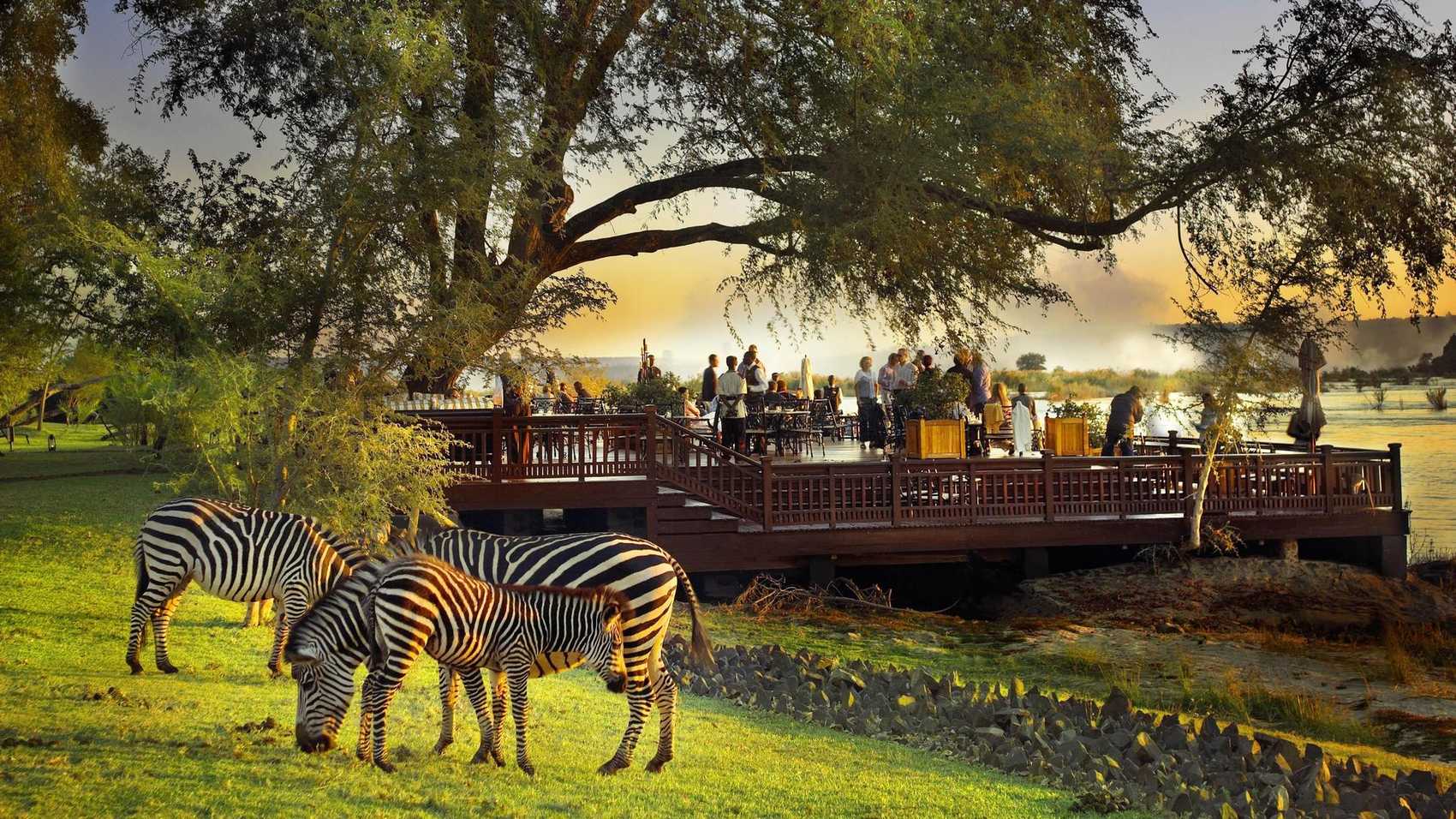
A Haven for Biodiversity
Victoria Falls is not just about the waterfall itself. The surrounding rainforest, fed by the constant spray from the falls, creates a unique microclimate that supports an incredible diversity of plant and animal life.
The Victoria Falls Rainforest is the only place in the region where rainforest vegetation grows naturally, sustained entirely by the mist from the falls. This lush environment is home to rare ferns, lianas, palms, and numerous tree species found nowhere else in Zimbabwe or Zambia.
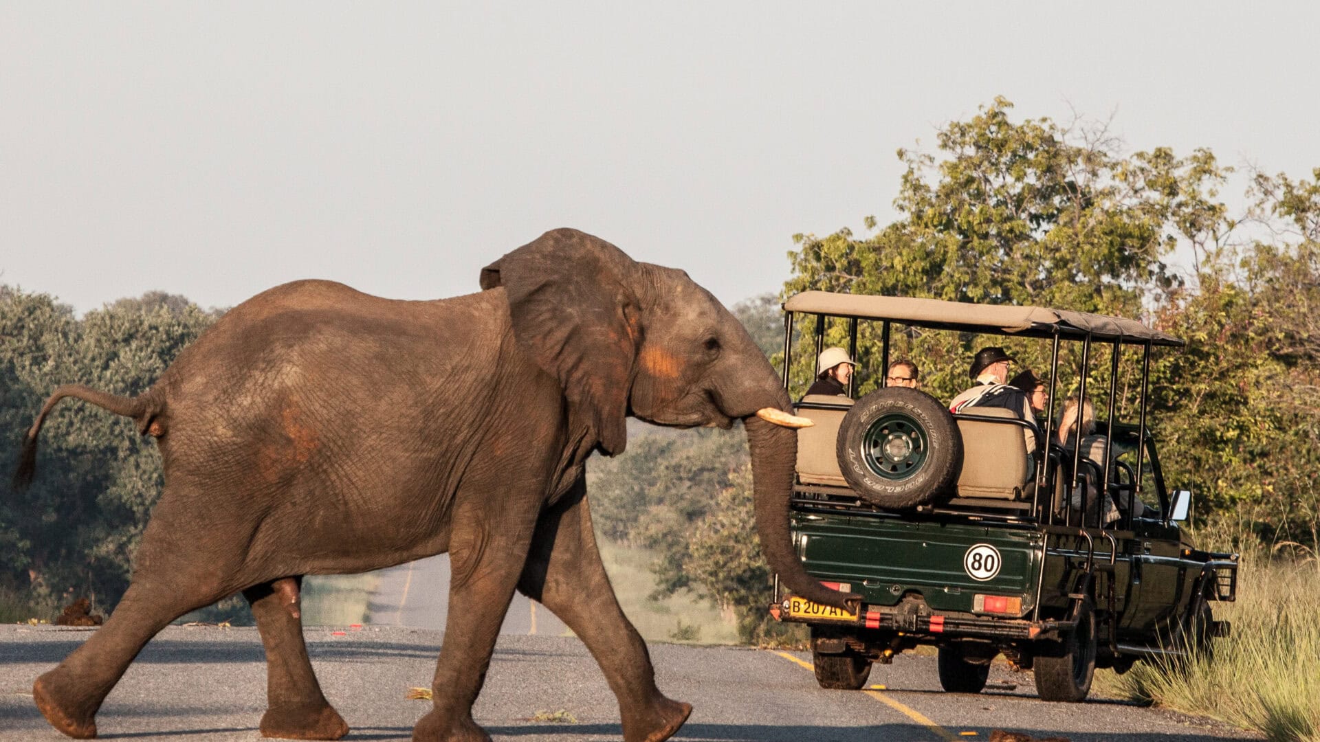
The Zambezi River above and below the falls teems with wildlife. Hippos and crocodiles are common sights, while the riverbanks attract elephants, buffalo, and a wide variety of antelope species. The area is also a birdwatcher's paradise, with over 400 bird species recorded.

Why Victoria Falls is Famous
Victoria Falls has earned its place among the world's most iconic natural wonders for several compelling reasons:
The World's Largest Waterfall
While not the tallest or widest individually, Victoria Falls is considered the largest sheet of falling water in the world when considering both height and width together. At peak flow, its combination of 1,708 meters width and 108 meters height creates a curtain of water unmatched anywhere on Earth.
Seven Natural Wonders
Victoria Falls is officially recognized as one of the Seven Natural Wonders of the World, placing it alongside the Grand Canyon, Mount Everest, and the Great Barrier Reef as one of the planet's most extraordinary natural phenomena.
UNESCO World Heritage Site
Designated a UNESCO World Heritage Site in 1989, Victoria Falls is recognized for its outstanding universal value, combining exceptional natural beauty with significant geological and ecological importance.
Adventure Capital of Africa
Beyond the falls themselves, Victoria Falls has become Africa's adventure capital, offering the world's highest commercial bungee jump, spectacular white water rafting, and countless other adrenaline activities. This combination of natural wonder and adventure opportunities is unmatched anywhere on the continent.
Ready to Experience Victoria Falls?
Now that you know about this incredible natural wonder, it's time to plan your adventure. Explore our comprehensive activity guides, read our insider tips, and discover the best ways to experience Victoria Falls.